Key facts at a glance
- Andong's height
- Reported as 1,726 m by most sources and 1,463 m by one operator, so treat the figure as approximate
- Start time
- One to three in the morning if you want sunrise; the walk is one and a half to two hours up
- Descent
- Around two hours, which is longer than people expect going down a trail that felt quick going up
- Route choice
- New route shows Merbabu; the old route hides it behind pine until the second post, and both rejoin at Watu Wayang
- Terrain
- Pine forest, then open savanna, edelweiss fields and exposed ridgeline
- Cold
- Genuinely cold at the summit before sunrise, even in the dry season
- Guide
- Not required; registration includes a trail map and the marked paths are clear
- Fee
- A small trail-maintenance fee paid at the basecamp warung, and cash is expected
Figures change without notice — treat this as a planning summary and confirm against the sources listed below.
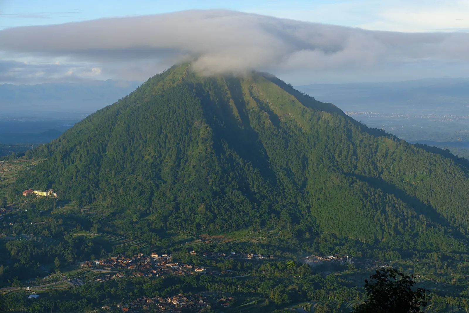
Andong is a hill, not a volcano, and that single fact changes the gear logic completely. There is no hazard framing, no exclusion zone, no monitoring station to check — you just walk up and stand on a ridge. It is also the most popular hike in the immediate area, popular since about 2012, and the crowd is mostly local.
What follows is what a walk up Andong, or a day at Ketep Pass, actually asks of your equipment.
The walk in three numbers
Roughly one and a half to two hours to the top, and around two hours back down. Fit hikers report 60 to 90 minutes up. Most people plan on the slow figures because the descent is where the time goes and because a crowded trail is slower than an empty one.
For sunrise you leave between one and three in the morning. For daylight, leave whenever you like and accept that you will be walking with the crowd.
Andong’s height is reported as 1,726 m by most sources including Central Java provincial tourism, and as 1,463 m by one operator. We use 1,726 m and flag the discrepancy rather than picking a side.
Four summits, and which one you actually want
The mountain has four summits lined up west to east: Makam (Tomb) Peak, Jiwa (Soul) Peak, Alap-alap Peak, and Andong Peak, which is the highest. Jiwa is the usual camping ground.
For a sunrise walk you want Andong Peak, the high point, because that is where the view opens. Jiwa matters if you are camping, not if you are walking up for the sunrise.
The route choice is the one decision that changes the walk
There are two marked routes, and they differ in the first hour rather than the last:
- The new route gives a clear view of Mount Merbabu from early on.
- The old route hides Merbabu behind thick pine forest until you reach the second post.
- Both rejoin at the third post, Watu Wayang. Past that the ridgeline opens to the horizon.
So the question is simply whether you want Merbabu in your photographs during the ascent or only at the top. Ask at the basecamp which way the marked trail is pointing, because the paths overlap at the start.
Once past Watu Wayang, the visible peaks include Merapi, Merbabu, Sindoro, Sumbing, Prau, Ungaran and Telomoyo, plus a panorama over the regency.
Gear: what each item is doing there
A headlamp, if you start in the dark. The lower section is pine forest with actual trees overhead, so a light is not optional for a one-in-the-morning start. Two things matter more than brightness:
- Beam width. A wide flood is far more useful on a dirt track with roots than a tight spotlight. You are navigating by obstacle avoidance, not by looking forty metres ahead.
- Red mode. It preserves the dark adaptation your eyes have built up over an hour of walking, so you can still see the ridgeline and the sky when you arrive at the viewpoint. This is the single feature people regret not having, because without it the approach destroys the very night vision the sunrise depends on.
A mid-layer, not a shell. This is the surprise. The regional temperature range is roughly 18 to 28 °C, but before sunrise at 1,700 metres on an exposed ridgeline, windchill makes it feel considerably colder. A merino or fleece layer is what solves that. A shell solves wind-driven rain, which is a wet-season problem, and does nothing for the temperature drop you get on a clear dry-season morning — which is the common case. Merino is preferable to synthetic for the same reason it is everywhere on this site: it does not hold odour, so it survives the walk and a humid shared vehicle afterwards.
Poles, mainly for the descent. The trail loses height steadily for about two hours on a surface that alternates between loose volcanic gravel and soft earth, and that combination is exactly what makes knees unhappy. Going up they help on the final steep section and do little else. If you own a pair, bring them; do not buy them for this walk.
Trail shoes, not boots. The path is maintained and marked, with no technical ground anywhere on it. A normal trainer with reasonable grip is enough. What actually matters is grip on the descent, particularly if it has rained recently, and on wet volcanic gravel grip matters much more than ankle support.
A twenty-litre pack. Enough for a layer, water, food, a headlamp and a rubbish bag, with room to spare. There is no bag-size limit here — that rule is Borobudur’s — but there is no shade or shelter either, so you carry what you need.
Water. There is no water at the top. Carry at least a litre, and more if you are going slowly. A wide-mouth bottle is easier to drink from while walking than a narrow sports bottle.
The summit is not wilderness
Andong has a nickname that is worth understanding rather than repeating: it is called the five-star mountain because there are food stalls and telecommunications signal at the summit. One of the warungs on Puncak Andong sells tea, coffee and simple food, and at least one account describes a shopkeeper who descends once a week and camps for the rest of the week.
That is genuinely convenient and it is also the reason the mountain is crowded. Plan on buying a hot drink at the top, and bring cash.
What people forget
In order of how often it comes up:
- Cash. The basecamp trail-maintenance fee and the summit stalls are both cash. There is signal at the top but that is not the same as a card machine.
- A warm layer. For a tropical mountain, almost nobody brings one, and almost everybody uses it.
- A rubbish bag. More packaging comes down from the summit stalls than up the trail.
- Sun protection. Open savanna and edelweiss fields at 1,700 m mean strong exposure once the sun is up, even when it is cool at dawn.
Weather and the safety line
Check BMKG before you start, and treat any official warning as overriding anything on this page. Two specific hazards on this hill:
- Lightning. An exposed ridgeline is the worst possible place to be in a thunderstorm, and the wet season produces plenty. Build the day around the morning or do not go.
- Wet roots and rock. The normal way people get hurt on Andong is slipping on wet volcanic rock or roots in the dark, not the weather itself. A wide headlamp beam is a safety feature here more than a convenience.
Ketep Pass is not a hike
Worth being clear about, because the two are often sold together. Ketep Pass is a roadside viewpoint at about 1,200 m, reached by vehicle, roughly 30 km north of Magelang city. You view Merapi as a full cone from about 30 km away. You are not looking into the crater, and this is a common error in published material.
So the gear logic differs. At Ketep you need a daypack, a layer, water and sun protection, and if you want photographs you need a lens that works at distance. You do not need poles, boots, or a three-in-the-morning headlamp.
The pairing that makes sense: Andong is the walk, Ketep is the viewpoint, and Andong is a hill while Ketep is a volcano landscape — so Andong is the safer of the two for a family. Our Magelang with kids guide covers how to combine them.
One honest caveat
This is a specification-first page, not a test report. We have not walked these trails in each of these products. The reasoning starts from the documented conditions — the timings, the elevation, the route layout, the terrain change from pine to savanna, the summit exposure — and works backwards to what a product has to do. Follow the links for current listings and compare across brands yourself. The reasoning is the part worth trusting; the listing is an example.
What to look for, and where to look
Criteria first. Follow a link to see a concrete example of each product type, or browse the category to compare brands yourself.
Lighting
-
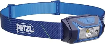
Petzl Tikkina headlamp
The buy-once option, if you intend to do sunrise walks regularly.
What to check
- A simple single-button interface you can operate while cold and tired
- Light enough to forget you are wearing it
- A housing that seals properly against rain
Worth the higher price only if sunrise walks become a habit. For one trip, a generic rechargeable headlamp is enough.
-
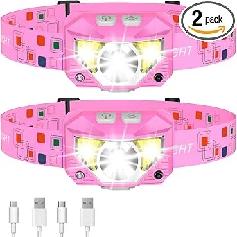
Wide-beam headlamp, two-pack
When a wide field of view matters more than reach, such as reading a path marker or a stall price board.
What to check
- A wide flood beam, because a narrow spot beam is useless for anything under your feet
- Two in a pack, so one can live in the bag and one can be worn
- A tilt mechanism, so you can aim it while wearing a cap
Two per household also solves the shared-battery problem when a group splits up for the night.
Hiking gear
-
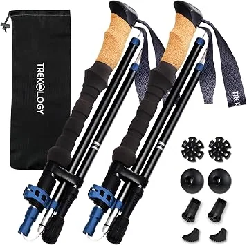
Collapsible trekking poles with cork grips
For saving knees on the descent from Mount Andong, and for saving your balance on wet stone.
What to check
- Cork or foam grips, not bare plastic, because plastic is unusable in sustained rain
- External or internal locks that are serviceable, and a lock that will not jam open in a bag
- A flick lock that locks in place with one motion
Descending is what injures people, not ascending. On the Andong descent the surface changes from trail to loose gravel without warning.
-
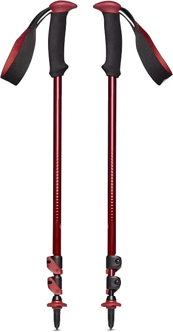
Aluminium trekking poles with FlickLock
The sturdier option, if you walk often or carry a heavy bag.
What to check
- Aluminium over carbon if you are hard on your gear, since aluminium bends rather than snaps
- A FlickLock-style external lock that can be adjusted with gloves on
- Replaceable tips and baskets, so one worn part is not a whole new pole
Carbon is lighter and better for a fast, light walk. Aluminium is the safer buy for repeated trips.
Footwear
-
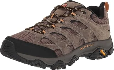
Hiking shoe with a lugged outsole and a reinforced toe
For Mount Andong, where pine litter gives way to loose savanna gravel without warning.
What to check
- A lugged outsole, because wet savanna gravel and a smooth sole do not mix
- A reinforced toe, since rock and root are common on the upper mountain
- A mid-height collar that still lets your ankle move on a controlled descent
Andong is a hill walk rather than a technical hike, but the upper sections are loose enough that grip matters more than ankle support.
-
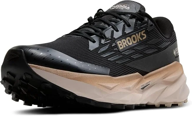
Waterproof trail running shoe with a lugged outsole
The wet-weather alternative, and the better choice for the Ketep Pass upper slopes in the wet season.
What to check
- A sealed or membrane upper rather than a coating, since coatings wear off within a season
- Drainage ports in the forefoot, because a waterproof boot that cannot drain becomes a problem on a long wet descent
- A lug pattern deep enough to still bite when the top layer of soil is saturated
For a normal dry-season Andong walk, the lighter non-waterproof shoe is the better buy. Waterproofing earns its place in the November-to-March window.
Bags
-
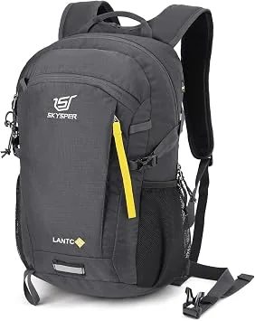
20L hiking daypack with padded strap and side bottle pocket
Carries the small bag you swap into shoes for, without becoming the bag you have to leave at the temple gate.
What to check
- 20L or under, because anything larger gets left in a locker
- A padded, breathable shoulder strap, not a webbing strap
- An external pocket that holds a 1L bottle upright
- A flat top that will sit on a wet stone step
The 3-litre bag limit at the Borobudur base is the single most common packing mistake. This size clears it without feeling bare-handed.
Clothing
-
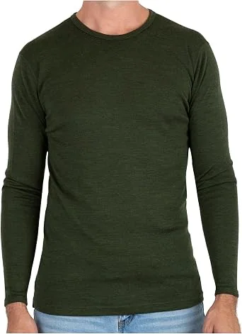
100% merino wool midweight long sleeve base layer
The layer that makes a 1am start and a 6am summit tolerable.
What to check
- 100% merino wool, not a cotton blend, because cotton stays wet
- Midweight rather than heavyweight, so it is not too hot in the tropical morning
- A fine micron count, because a coarse wool against damp skin is misery
Merino is the reason a long walk at a 1,700m summit is possible at dawn. Synthetic layers dry faster; merino does not smell after a long day.
Links open Amazon. We are not the seller and we do not handle the order. A purchase changes nothing about what this site recommends. How this works.
Sustainable Tip
Carry your own rubbish bag down. The summit stalls generate more packaging than the trail does, and it ends up on a ridge with nowhere to put it.
Family Tip
Older children can do this walk and it is a genuine achievement for them. Younger ones will find the three-in-the-morning start impossible, so either go in daylight on a weekday, or accept that this is an adult trip with a view rather than a shared one.
Frequently asked questions
Is a headlamp genuinely required for Mount Andong?
For a sunrise start, yes. Most people leave the basecamp between one and three in the morning, and the lower section is pine forest with real trees overhead, so without a light you are following a dark trail by shape and feel rather than by sight. A wide beam is more useful than a bright narrow one on a dirt track with roots. If you are walking up in daylight, you do not need one.
Do I need trekking poles for Andong?
Only if you are descending. The trail loses height steadily for around two hours and the surface alternates between loose volcanic gravel and soft earth, which is exactly the combination that makes knees unhappy on the way down. On the way up they are nice to have for the final steep section and unhelpful on the rest. If you own a pair, bring them. If you do not, this is not the hike to buy them for.
How cold does it actually get at the top?
Cold enough that you will want a layer on, which surprises people planning a tropical hike. The regional temperature range is roughly 18 to 28 C, but before sunrise at 1,700 metres with wind across an exposed ridgeline, the windchill makes it feel substantially colder. A merino or fleece mid-layer under a shell is the combination that works, and it is a case where the layer matters more than the shell.
Are trail shoes necessary or will normal trainers do?
Normal trainers with reasonable grip are enough for this trail. It is a maintained and marked path rather than technical ground, and no part of it requires a boot. Trail shoes are worth having for grip on the wet sections and on the loose descent, but this is not the walk to buy boots for. If the trail is wet from recent rain, grip matters much more than ankle support.
Do I need a guide at Mount Andong?
No. No guide is required, registration includes a trail map, and the paths are well marked. There are six basecamps. What you pay at the basecamp warung is a small trail-maintenance fee, and cash is expected. The thing to check before you start is which of the two routes you are on, because the new and old routes give completely different views of Merbabu in the first hour.
What should I bring that people usually forget?
Cash, for the basecamp fee and for the food stalls at the summit, which are the reason the mountain has its nickname. A warm layer, which almost nobody brings for a tropical mountain. And a rubbish bag, because the mountain is crowded at weekends and the summit stalls generate more packaging than the trail does.
Is Ketep Pass a hike at all?
No, and this is a distinction worth keeping clear. Ketep Pass is a roadside viewpoint at around 1,200 m reached by vehicle, and you view Merapi from about 30 km away rather than looking into the crater. Mount Andong is the actual walk. Andong is a hill rather than a volcano, which is precisely why it is the safer pairing for a family: there is no volcanic hazard framing attached to it at all.
How crowded is it?
Crowded, especially at weekends and on public holidays, and most of that crowd is local hikers. The mountain has been popular since around 2012 for reasons that are mostly social-media-driven. Weekday mornings are the quietest option. This matters for gear in one specific way: a wide headlamp beam is better than a narrow one, because the person in front of you on a narrow trail with a narrow beam is following the person in front of them.
Tourism information — including opening hours, entrance fees, and transport routes — may change. Please verify with official local sources before planning your visit.
Sources and further checks
Use these primary or specialist sources to confirm current access rules, safety notices, and travel arrangements.

About the Author
Larasati Wulandari
Independent travel writer · Central Java, Indonesia
Larasati Wulandari is an independent travel writer who has lived in Central Java for eight years. She writes first-hand, practical guides to Magelang's temples, viewpoints, and local food, and reviews them regularly as conditions change.