Key facts at a glance
- Elevation
- 1,726 m is the widely used figure; one operator lists 1,463 m
- Type
- Hill walk, not a volcano — no volcanic hazard rules apply
- Summits
- Four: Makam, Jiwa, Alap-alap and Andong, the highest
- Time to the top
- About 1.5 to 2 hours up, around 2 hours down
- Basecamps
- Six, including Sawit, Pendem, Gugik and Temu
- Guide
- Not required; registration includes a trail map
- Fee
- A small maintenance fee paid at the basecamp stall
- Best time
- Before dawn for sunrise and the clearest air
Figures change without notice — treat this as a planning summary and confirm against the sources listed below.
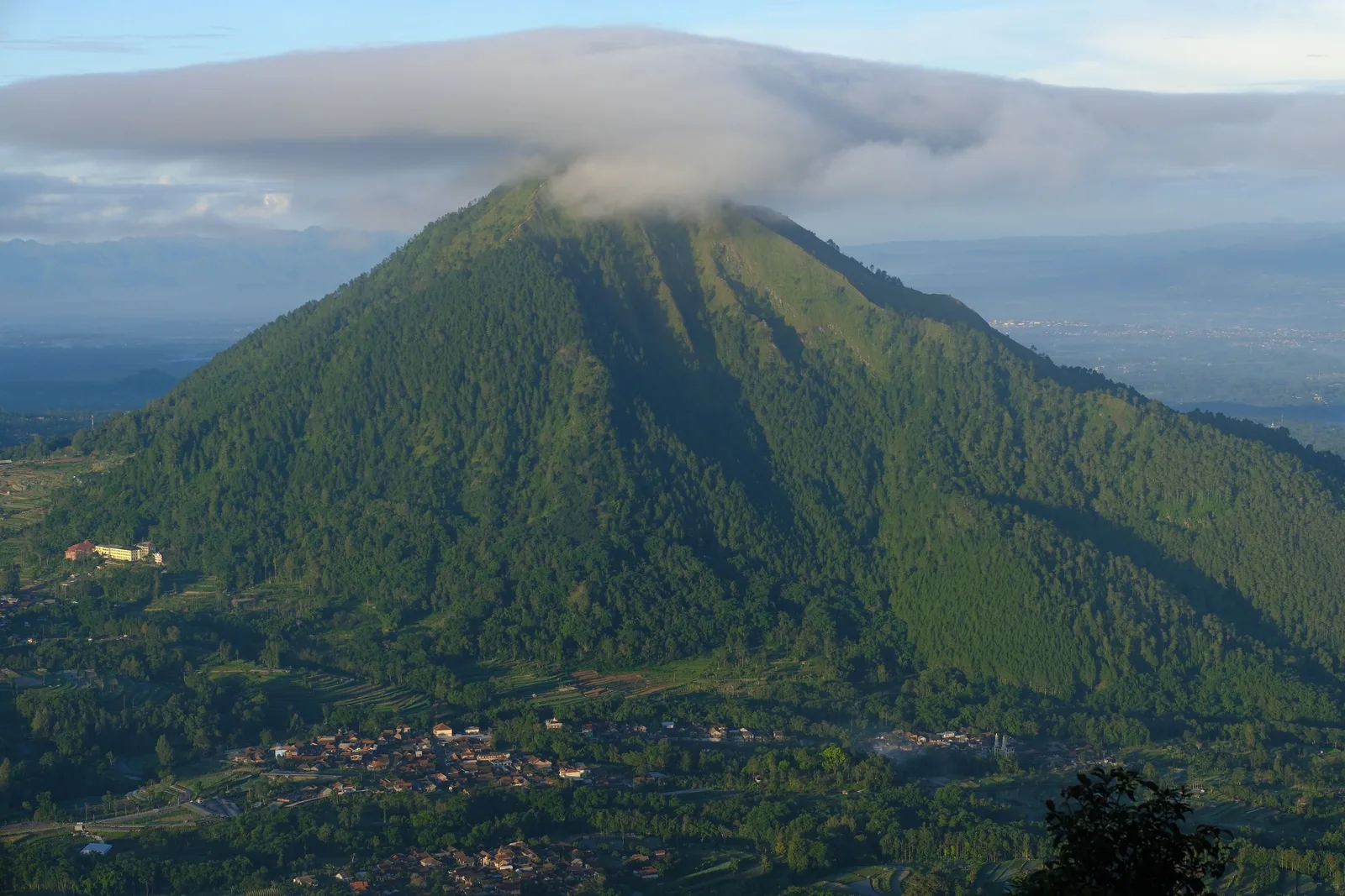
Most visitors to Magelang come for a temple, a food stop and a photograph of Borobudur. If you have a spare half day and want to be outdoors rather than in a queue, Mount Andong is the better use of it. It is a proper walk rather than a stroll, it is close to beginner level, and the view from the top justifies the effort.
Critically, it is also not a volcano, which makes it a different proposition from the rest of this region’s mountain attractions.
Why Andong Is Different from Everything Else Here
This is the single most useful thing to understand before you book anything.
Ketep Pass looks at Mount Merapi from roughly thirty kilometres away, and anywhere closer to Merapi you are dealing with an active volcanic system where official safety guidance takes priority over any travel plan. Andong involves none of that. It is a hill in the hills north of Magelang, with a summit, some forest, and a very good view.
There is no crater to see into, no ash to worry about, no monitoring level to check. Nobody needs to clear you with a volcanological authority. The hazards here are ordinary mountain hazards: slipping, cold, and being under-prepared for an early start.
That makes it the sensible pairing with Ketep Pass in the same trip. One gives you the volcano landscape safely at a distance, the other gives you the physical effort and the open ridgeline. Together they make a full day in the north of the regency without either of them being a serious undertaking.
Four Summits in a Line
Andong is unusual in having four peaks rather than one. They run west to east: Makam Peak, Jiwa Peak, Alap-alap Peak and Andong Peak, which is the highest. You do not need to reach all of them.
The one people care about is Jiwa Peak, because it is the usual camping ground. If you are staying up there to watch sunrise rather than hiking up for it, Jiwa is where the tents end up.
The summit proper is reached on a sloping return path marked out on the ground, which is a slightly anticlimactic ten minutes after the drama of the ridgeline — but it is where you get the full horizon.
The Two Routes, and Which One to Take
There is an older and a newer trail. Both have three posts, and both rejoin at the third post, which is called Watu Wayang.
The practical difference is Merbabu. On the new route you can see Mount Merbabu clearly. On the old route the view of Merbabu is blocked by thick pine forest, and it does not appear until you are past the second post. If Merbabu is the mountain you most want to see, or if you are going for a sunrise and want to know what you are looking at when you get to the top, the newer route is the better choice.
From the third post onwards, the canopy opens and the view runs out to the horizon. On a clear morning you can pick out Merapi, Merbabu, Sindoro, Sumbing, Prau, Ungaran and Telomoyo, with the whole of Magelang Regency spread out below.
The trail itself changes character as you climb. It starts through coniferous forest, quite enclosed and quiet. As you gain height the vegetation thins, the ground opens out into savanna, and you get edelweiss fields and open ridgelines. That transition is the best part of the walk, and it is why people photograph the middle of Andong more than the top.
Getting There, and Getting Started
Andong sits between Ngablak and Tlogorjo in the Grabag area, in the north of the regency, next to Mount Telomoyo and close to the boundary of the Salatiga, Semarang and Magelang regions.
There are six official basecamps. Four are in Ngablak sub-district — Sawit (registered as Taruna Jaya Giri), Pendem, Gugik and Temu — and two are in Grabag, Kudus and Sekararum Kembangan. Pendem is the one most commonly used and is around 22 km out.
At the basecamp you register, get a trail map, and pay a small fee at the warung towards trail maintenance. There is a parking area and a stall selling drinks and snacks. No guide is required.
Allow 1.5 to 2 hours up and about 2 hours down. Fit hikers report 60 to 90 minutes for the ascent. If you are going for sunrise you need to leave in the small hours — most people start walking at around 1 to 3 am, which means arriving at a basecamp in the dark.
It is worth being honest that this is not a remote or wild hike. It is a popular, well-used trail with signage and regular foot traffic, and you will not be alone. Since around 2012 it has been heavily promoted on social media, and it is busy, particularly at weekends, with a lot of local hikers.
The Summit Has a Warung, and That Is the Point
Andong has an odd and genuinely charming feature: there are food stalls and mobile network coverage at the top. A warung on the summit sells tea, coffee and simple food. One account of it notes that the shopkeeper climbs down only once a week and camps on the mountain the rest of the time.
This is the source of the nickname it has picked up among locals and Indonesian hikers — the “five-star mountain”. It is not a formal classification of any kind. It is a joke about the fact that you can buy a hot drink at the top of a hill at dawn, which is not normal.
You should still bring your own supplies. Do not rely on summit stock, and do not rely on it for early starts.
Cold, Weather, and the Best Time to Walk
Bring warm layers. This is the most repeated practical warning in every account of this hill, and it is not a formality. The summit is well below the temperature the lowland forecast implies, there is exposed ridge at dawn, and the wind at the top does not care what the thermometer in Magelang said at six in the morning.
The best time is before dawn, for two reasons. Sunrise is the reason most people come, and the air is clearer in the hours before and just after the sun comes up, which is when the distant peaks are visible. Later in the day the haze builds and the panorama closes in.
Check the forecast the night before and treat heavy rain or fog the same way you would anywhere else on a hill in Central Java — do not go. If the sky is closed in, the rainy season guide has suggestions for what to do instead, and Andong is not a good substitute for a cloud-topped summit.
The hiking gear guide for Andong and Ketep Pass works through what to actually carry for a 01:00 start on a cold summit — including the headlamp detail that matters most at four in the morning, and why the poles earn their place on the way down rather than the way up.
Who This Is For
Andong is beginner-friendly and is widely recommended as a first proper hike in Indonesia. That makes it a good choice if you want a real walk but not an ordeal, and a good way to test whether mountain days suit you before attempting anything in the Merbabu or Merapi area.
It suits older children with reasonable fitness. The trails are straightforward and the main risk is fitness, not technical difficulty. It does not suit younger children, anyone with knee problems, or anyone who cannot manage about an hour of steady uphill walking. The stairs near the ridgeline are the part that catches people out. The Magelang with kids guide covers how to build a family day around this hill, and the hiking gear guide covers footwear and the kit list specifically for children coming along.
If you want a genuine challenge with a real summit and real altitude, Andong is not it — it is a hill with a very good view. But if you want to be above the plain at dawn, surrounded by volcanoes you never have to climb, it is excellent value for the effort.
Pairing It With the Rest of the Region
Andong is in the far north of the regency, which makes pairing easy if you are already touring that way.
Mount Telomoyo is next door and is the counterpoint: it is one of the few peaks in Central Java you can reach by vehicle, with a motorbike or jeep able to drive up the narrow road, and cars parking at the gate. Ten minutes of effort for a comparable view, which makes it the option to choose if you want the panorama without the climb.
Ketep Pass with its volcano museum is also close, and combines well in a single day — the volcano landscape in the morning, the hill walk if you have the legs for it, or the museum if you do not. The hiking gear guide covers both sites in one place, because the kit list overlaps almost entirely and the only real difference is the effort.
For that kind of day planning, the 2-day itinerary and the 3-day itinerary both work, and the budget guide covers what a day of transport and food in the north of the regency actually runs to.
Read this before you go: check the current weather, go early, take layers, and take cash for the basecamp stall.
Gear this page assumes you already have
If you have not assembled this yet, the specs matter more than the brand. Follow a link for an example, or compare the category.
Lighting
-
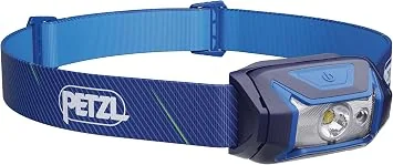
Petzl Tikkina headlamp
The buy-once option, if you intend to do sunrise walks regularly.
What to check
- A simple single-button interface you can operate while cold and tired
- Light enough to forget you are wearing it
- A housing that seals properly against rain
Worth the higher price only if sunrise walks become a habit. For one trip, a generic rechargeable headlamp is enough.
-
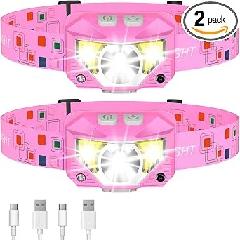
Wide-beam headlamp, two-pack
When a wide field of view matters more than reach, such as reading a path marker or a stall price board.
What to check
- A wide flood beam, because a narrow spot beam is useless for anything under your feet
- Two in a pack, so one can live in the bag and one can be worn
- A tilt mechanism, so you can aim it while wearing a cap
Two per household also solves the shared-battery problem when a group splits up for the night.
Hiking gear
-
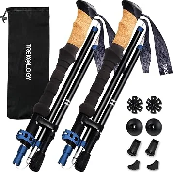
Collapsible trekking poles with cork grips
For saving knees on the descent from Mount Andong, and for saving your balance on wet stone.
What to check
- Cork or foam grips, not bare plastic, because plastic is unusable in sustained rain
- External or internal locks that are serviceable, and a lock that will not jam open in a bag
- A flick lock that locks in place with one motion
Descending is what injures people, not ascending. On the Andong descent the surface changes from trail to loose gravel without warning.
Footwear
-
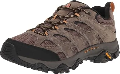
Hiking shoe with a lugged outsole and a reinforced toe
For Mount Andong, where pine litter gives way to loose savanna gravel without warning.
What to check
- A lugged outsole, because wet savanna gravel and a smooth sole do not mix
- A reinforced toe, since rock and root are common on the upper mountain
- A mid-height collar that still lets your ankle move on a controlled descent
Andong is a hill walk rather than a technical hike, but the upper sections are loose enough that grip matters more than ankle support.
Clothing
-

100% merino wool midweight long sleeve base layer
The layer that makes a 1am start and a 6am summit tolerable.
What to check
- 100% merino wool, not a cotton blend, because cotton stays wet
- Midweight rather than heavyweight, so it is not too hot in the tropical morning
- A fine micron count, because a coarse wool against damp skin is misery
Merino is the reason a long walk at a 1,700m summit is possible at dawn. Synthetic layers dry faster; merino does not smell after a long day.
Hydration
-
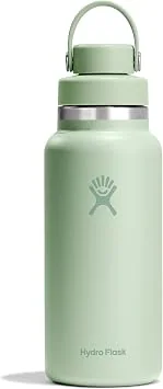
1L insulated stainless steel bottle, wide mouth
For the Borobudur climb, where you cannot drink once you are on the structure.
What to check
- A 1L capacity, which still leaves room for a bag in the same pocket
- Double-wall vacuum insulation, because uninsulated water in Central Java is unpleasant within an hour
- A wide mouth, so it can actually be cleaned rather than merely rinsed
- A narrow drinking spout, so it does not slop down a shirt while you are climbing stairs
Drinking is not permitted while on the Borobudur structure. You fill up at the entrance water stations and carry the bottle the entire way up and down.
Links open Amazon. We are not the seller and we do not handle the order. A purchase changes nothing about what this site recommends. How this works.
Frequently asked questions
Is Mount Andong a volcano?
No, and this is worth being clear about. Andong is a hill walk in the hills north of Magelang. Unlike Ketep Pass, there is no crater, no volcanic activity to monitor and no volcanic hazard framing at all. That makes it a very different proposition from the volcano sites in this region.
How long does the climb take?
Around 1.5 to 2 hours to the top depending on your fitness and pace, with roughly 2 hours for the descent. Fit hikers report 60 to 90 minutes up. If you plan to watch the sunrise, most people leave a basecamp around 1 to 3 am.
Do I need a guide?
No. Registration at the basecamp includes a trail map and the paths are well marked. There are two routes, an older and a newer one, which rejoin at the third post. A small fee is paid at the basecamp stall towards trail maintenance.
What can I see from the top?
A wide panorama of Central Java's volcanic skyline. Depending on which part of the ridge you are standing on you can see Merapi, Merbabu, Sindoro, Sumbing, Prau, Ungaran and Telomoyo, along with a sweep of Magelang Regency below.
Which route should I pick?
The newer route gives a clear view of Mount Merbabu. On the older route Merbabu is blocked by thick pine forest until you pass the second post. Both routes have three posts and rejoin at Watu Wayang, and the views open up properly from that point onwards.
What are the four summits?
Makam, Jiwa, Alap-alap and Andong Peak, lined up west to east, with Andong Peak the highest. Jiwa Peak is the one usually used as a camping ground.
Is it suitable for children?
Older children with reasonable fitness can manage it, and the trails are among the more beginner-friendly walks in Indonesia. Younger children, anyone with knee problems, and anyone who cannot manage an hour of steady uphill walking should pick a different plan.
What do I take with me?
Warm layers. It gets genuinely cold at the summit, well below what the lowland weather suggests, and there is exposed ridge at dawn. Also take water, a headlamp, a dry layer for the walk down, and cash for the basecamp stall.
Tourism information — including opening hours, entrance fees, and transport routes — may change. Please verify with official local sources before planning your visit.
Sources and further checks
Use these primary or specialist sources to confirm current access rules, safety notices, and travel arrangements.

About the Author
Larasati Wulandari
Independent travel writer · Central Java, Indonesia
Larasati Wulandari is an independent travel writer who has lived in Central Java for eight years. She writes first-hand, practical guides to Magelang's temples, viewpoints, and local food, and reviews them regularly as conditions change.