 Save
Key facts at a glance
- Location
- On a shoulder between Merapi and Merbabu, about 30 km north of Magelang city
- Elevation
- Around 1,200 m above sea level, on a site of roughly 8,000 square metres
- What you see
- A full cone of Merapi to the south, Merbabu to the north; Sumbing, Sindoro and Slamet on clearer days
- Key point
- You view Merapi from roughly 30 km away; this is not a crater-rim visit
- Three separate tickets
- The pass itself, the Volcano Centre museum, and the Volcano Theatre are billed separately
- Official status
- Merapi is held at Level III, Alert, by BPPTKG; check MAGMA and BMKG before travelling
- The real risk
- Road, altitude and sudden loss of visibility, not the volcano
- Time needed
- One to two hours, paired with a second stop rather than a chain of viewpoints
Figures change without notice — treat this as a planning summary and confirm against the sources listed below.
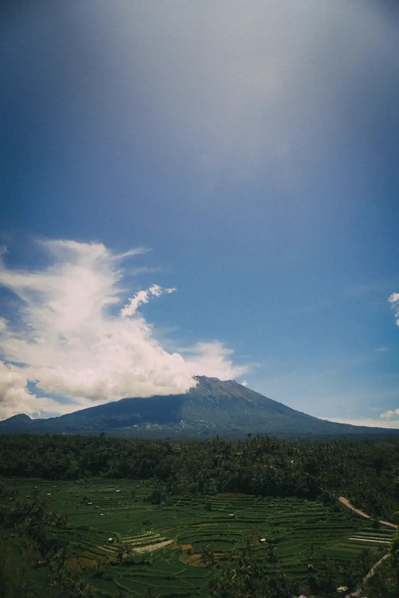
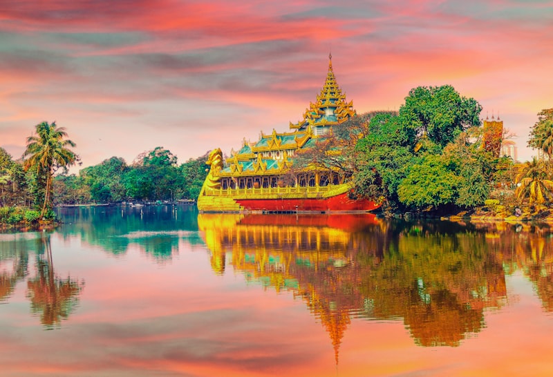
Ketep Pass is a highland viewpoint in Magelang Regency, roughly 30 km north of Magelang city at around 1,200 metres, on a shoulder of Sawangan Mountain that bridges Merapi and Merbabu. On a clear day you see Mount Merapi to the south and Mount Merbabu to the north, standing either side of a cultivated valley full of villages and terraced slopes. On the clearest days the regional tourism sources add Sumbing, Sindoro, and Slamet to the list.
Two things to be clear about from the start.
First, Ketep Pass is about mountain weather, not about the mountain’s danger. Merapi is an active volcano and official volcanic information matters — but the practical risks at this site are the road, the altitude, the cold, and sudden changes in visibility.
Second, you are looking at Merapi from a considerable distance. You see the complete cone across the valley. You do not see into the crater and you are not on the mountain. Any photograph claiming to be a crater-rim view taken from Ketep Pass is misleading, and it is a common error in the material online about this place.
What makes the view worth the drive
On a clear morning you get:
- Mount Merapi as a full cone across the valley, often with cloud sitting in the saddle below it.
- Mount Merbabu on the opposite side, so the geography of the Kedu valley reads as a single scene rather than a single peak.
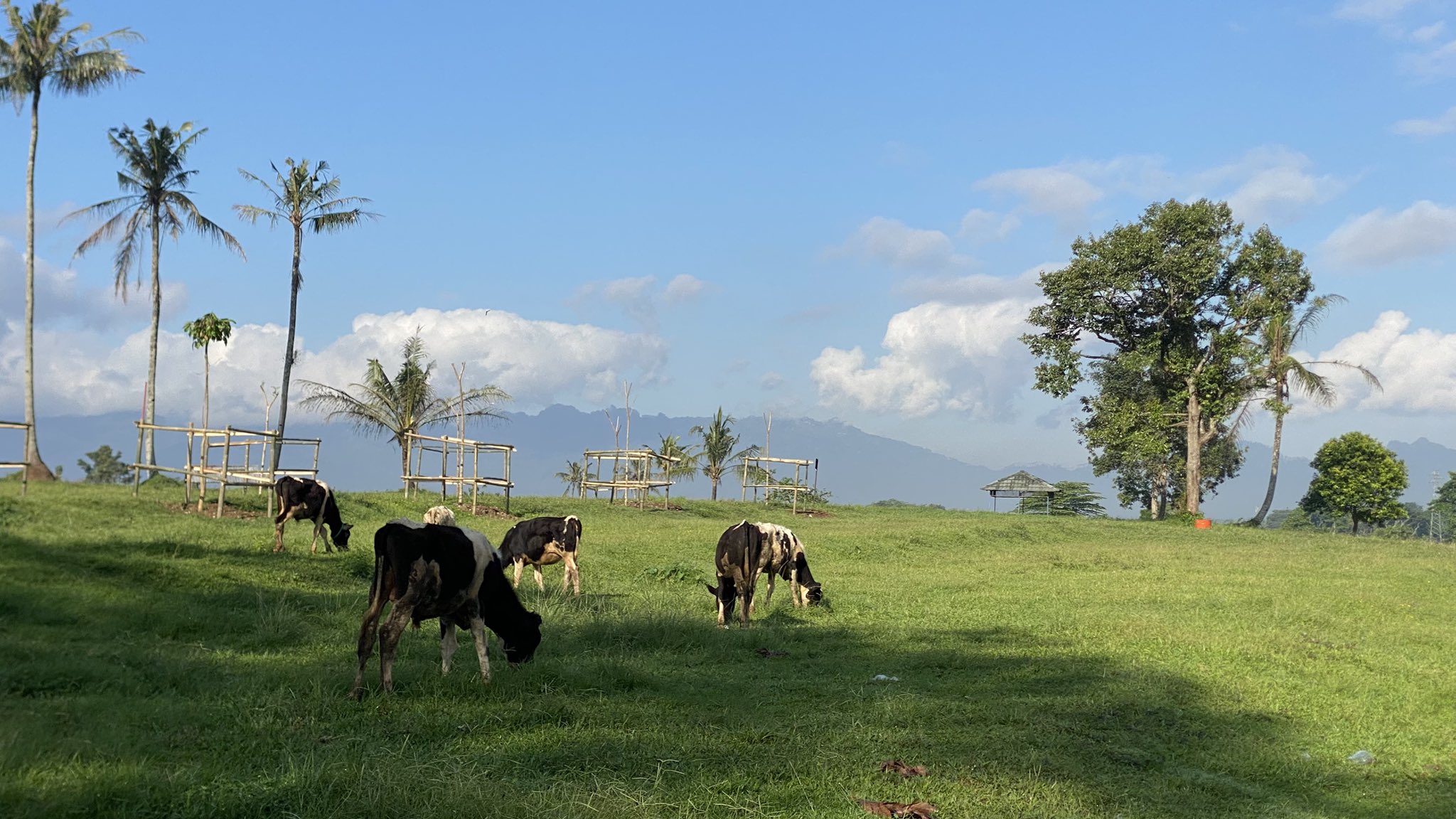
- The cultivated highlands below — villages, terraced fields, and the pattern of agricultural land that fills most of the frame.
- Fast-changing conditions. Cloud moves across these slopes quickly, and a view that was clear five minutes ago may not be.
The light in the first hour after dawn is generally better than at midday, when haze reduces contrast. But arriving before dawn means driving a mountain road in the dark, which is its own problem — see below.
Two volcanoes that are not equally dangerous
They stand either side of the valley and they look interchangeable. The historical record does not treat them that way.
Merapi rises to 2,968 m and is among the most active volcanoes in Indonesia, producing an eruption something like every two to five years. Eruptions in the area began around 400,000 years ago, and the character of the activity has changed over that span: early activity was largely effusive with basaltic lava, while the modern behaviour involves viscous andesitic lava generating lava domes. The domes are the problem. They build, they collapse, and they produce pyroclastic flows — fast-moving avalanches of hot gas and rock. Merapi is the youngest and southernmost of a chain running north-northwest to Ungaran.
Its lethal history is not abstract. Notable eruptions occurred in 1006, 1786, 1822, 1872, and 1930. The 1930 eruption destroyed thirteen villages and killed around 1,400 people in pyroclastic flows.
Merbabu, 3,118 m, has a far quieter record. The Smithsonian’s Global Volcanism Program recognises only two well-attested eruptive periods, in 1560 and 1797, the latter assigned a Volcanic Explosivity Index of 2. A reported 1570 event remains uncertain, and an eruption once attributed to 1586 has been discredited outright. Merbabu is a large forested stratovolcano cut by three radial valleys, and it produced the big Kopeng and Kajor lava flows on its northern and southern flanks, but it is not Merapi.
Both are monitored. They are not the same risk, and treating them as a pair is how well-meaning advice becomes useless.
The 2010 eruption, and why it is the right thing to read about
If you want one piece of background reading before visiting, make it the eruption of 2010, because it explains the monitoring culture you will meet and it is the best available illustration of how dangerous Merapi can be.
Between 26 October and 7 November 2010, Merapi produced its largest and most explosive eruptions in more than a century. It did not start conventionally: the sequence opened with an explosive eruption on 26 October that created a new summit crater and sent pyroclastic flows 8 km down the flanks. After a period of rapid dome growth, a paroxysmal VEI 4 eruption struck on the night of 4–5 November, raising an ash column to 17 km, destroying a summit lava dome of about 5 million cubic metres, and driving pyroclastic flows roughly 16 km down the Gendol drainage.
The toll was severe: at least a third of a million people displaced and nearly 400 lives lost, with the Cangkringan area closest to the summit the worst affected. Indonesian forecasting is widely credited with saving between 10,000 and 20,000 lives through timely warnings of the eruption’s scale. The ash plume reached about 7,600 m and spread more than 100 km downwind, and the danger zone was extended 20 km from the summit.
The secondary killer is worth knowing about, because it is the one that catches people who assume the danger is only explosive. Lahars — mudflows of volcanic debris and rainwater — travelled down the Code River as far as Yogyakarta, 30 km away. Volcanic rivers and valleys are the hazard footprint, not a simple radius.
A consequence you may encounter on the slopes today: several villages destroyed in 2010 have been rebuilt, and with the farmland gone, some residents have turned to taking visitors to the destruction. It is a form of disaster tourism, and whether you take it up is your own call, but going with your eyes open is better than being surprised by it.
The 1006 story, and why it is worth knowing
You will meet a claim that a catastrophic Merapi eruption in 1006 buried Borobudur, Mendut, and Prambanan, devastated central Java, and forced the Mataram kingdom to migrate east. It is not fringe — it appears in respectable literature and it has shaped how people talk about the relationship between the volcano and the temples.
It also did not survive checking. Early Dutch geologists proposed and then elaborated it across several decades. Later researchers examined the stratigraphy and the archaeological record and found no evidence of a catastrophic eruption at that date, and no archaeological indications of one in either 928–929 or 1006. Their conclusion is worth quoting, because it applies far beyond volcanoes: the 1006 eruption is a classic example of a reasonable speculation that has been transformed into a fact by uncritical repetition.
The broader point is useful for your visit too. When someone on a viewpoint tells you a dramatic story connecting Merapi to the temples, ask which part is documented and which part is inference.
The museum is the reliable part
The site has more ticketed facilities than most guides admit, and it is worth separating them because they are billed separately and have their own schedules:
- The pass itself, which historically charged a foreign-visitor entrance fee that bundled in access to the museum and cinema, a telescope, and a soft drink in the restaurant. Published figures have ranged widely and are clearly out of date.
- The Ketep Volcano Centre, a volcanology museum holding a model of the mountain, rock samples from past eruptions, and photographs of the volcano year by year.
- The Ketep Volcano Theatre, which runs a documentary film about Merapi’s volcanic activity on fixed daily hours.
Fees, opening times, and what is bundled change without notice, so confirm on the day rather than budgeting from a figure you read online.
This deserves more attention than it usually gets, because of the nature of the site: the mountain view is genuinely unreliable, and the museum is not. You will see both volcanoes on a poor day perhaps one time in five. You will always have the exhibits, the rock samples, and the film.
That makes Ketep Pass a much better proposition for a family group or an educational visit than its reputation as a photo stop suggests.
Safety: separate the two questions
People conflate these and it causes both real problems and pointless anxiety.
Volcanic activity. Before travelling, review MAGMA Indonesia and BMKG, the official sources run by the Ministry of Energy and Mineral Resources and the national weather and geophysics agency. Merapi has been maintained at Level III, Alert, with hazard zones extending several kilometres down the Kali Krasak, Boyong, Bedog, and Bebeng river valleys to the south-southwest, and further zones to the southeast, and with explosive ejecta possible within about 3 km of the summit. Read it for awareness. Then understand that you are not in a position to assess volcanic conditions yourself, and a viewpoint visit is not a way to monitor a volcano. Do not enter restricted areas, do not follow informal routes, and do not treat a travel article as an advisory. If there is any official restriction affecting access, it overrides everything on this page.
The road and the weather. This is where the actual risk sits. Mountain roads change with rain. Visibility drops fast. The temperature at 1,200 m is meaningfully colder than in the valley, and wind can be strong enough to be unpleasant.
Verify current opening hours, admission, road conditions, and any restrictions through the local operator or Magelang Regency Government before setting out. Do not take these details from an old travel post.
Know your turnaround point. Decide before you leave where you will stop if visibility drops. On a winding mountain road with limited places to turn around, having a decision made in advance is what separates a delay from a problem.
Getting there
Use a driver familiar with mountain roads, or arrange transport through a reputable accommodation provider. This is not a place to navigate from a map on your phone.
Carry a warm layer, rain protection, and water, and allow more time than you think you need — mountain roads are slower than they look. Do not rely on a phone signal for navigation. Keep fuel and a charged phone available before you start the climb. The rain gear guide for the highlands covers the specific failure mode here: at a roadside viewpoint you stand in the open, so wind-driven rain gets through a jacket that would have been fine on a moving walk.
Plan for the area, not just the pass. There is genuinely more here than one viewpoint. A roughly 30 m waterfall lies about 3 km to the east — the Kayang Waterfall guide covers the walk and, importantly, the conditions that decide whether it is worth doing. Strawberry farms sit close enough to pick your own fruit, priced by the gram, which is usually the part children remember. A small group of 8th and 9th century Hindu temples — Asu, Lumbung, and Pendem — stands a few hundred metres from the village of Tlatar, and local drivers will detour to them if you ask when you arrange the trip. The Candi Asu and Sengi guide explains which of the three is worth stopping for, and why it is not on the Borobudur axis that most itineraries assume. There are food stalls and a restaurant on site, roasted corn is a local staple, and there is a teahouse nearby with an afternoon sunset view.
Building a viewpoint day that works
Keep the day deliberately light. The pattern that works:
- Check conditions first. Weather forecast and MAGMA status, both, before committing.
- Choose one viewpoint. Ketep Pass, or Punthuk Setumbu near Borobudur — not both on the same morning, because they pull in opposite directions.
- Add a flexible meal or an indoor stop rather than chaining a second mountain destination.
- Leave slack for cloud, road delays, and the possibility that neither mountain is visible.
For a different highland character, Propang Ranch works as a slower alternative, and Kayang Waterfall suits a gentler walk. If you want actual effort rather than a roadside view, Mount Andong is a beginner hill walk in the same northern part of the regency — and because Andong is not a volcano, it carries none of the hazard framing that governs this site, which makes the two a natural pairing across one day. If your dates fall between roughly November and March, read the rainy season guide first — cloud will usually beat both viewpoints, and it is better to plan around that than to be disappointed.
If you are travelling with children, older relatives, or anyone sensitive to cold or motion sickness, discuss the road, the facilities, and the turnaround plan with your driver in advance. Altitude, a winding road, and an early start are the real constraints, not the site itself.
A safe turnaround is a successful day. For a lower-impact framing of the whole region, the sustainable travel guide covers the wider patterns.
Gear this page assumes you already have
If you have not assembled this yet, the specs matter more than the brand. Follow a link for an example, or compare the category.
Rain gear
-

Lightweight packable windbreaker with taped seams
A cheaper, lighter layer that handles drizzle and wind but not sustained heavy rain.
What to check
- A stated waterproof rating, so you know which jobs it can do
- Fully taped seams, not only a coated fabric
- Elastic cuffs and a drawcord hem, which stop the rain running down your arms
Useful as a packable top layer for highland wind at Ketep Pass and Andong, where drizzle is more common than downpour.
Lighting
-
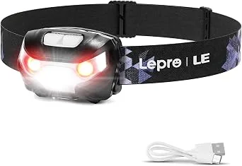
Rechargeable headlamp with a red-light mode
For the 1am starts that the Andong and Ketep sunrise routes require.
What to check
- A red-light mode, so you can read a map without wrecking your night vision
- USB rechargeable rather than button cells
- A runtime long enough for a night out, because sunrise walks start in the dark
Mount Andong sunrise walks typically mean leaving between 1am and 3am. That is several hours of unlit trail, not a brief pre-dawn walk.
Hydration
-
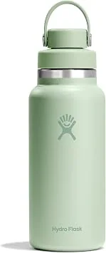
1L insulated stainless steel bottle, wide mouth
For the Borobudur climb, where you cannot drink once you are on the structure.
What to check
- A 1L capacity, which still leaves room for a bag in the same pocket
- Double-wall vacuum insulation, because uninsulated water in Central Java is unpleasant within an hour
- A wide mouth, so it can actually be cleaned rather than merely rinsed
- A narrow drinking spout, so it does not slop down a shirt while you are climbing stairs
Drinking is not permitted while on the Borobudur structure. You fill up at the entrance water stations and carry the bottle the entire way up and down.
Bags
-
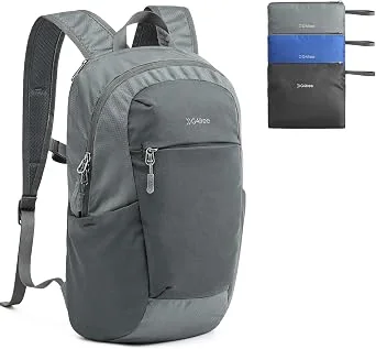
18L packable daypack that folds into its own pocket
For the traveller who did not think far enough ahead to buy a bag before the flight.
What to check
- Packs into itself, so it takes up no luggage space
- When unfolded it still has a padded strap and a closed lid
- A zipped main compartment, not a drawstring only
A reasonable emergency bag for Magelang, where buying a replacement locally is not always straightforward.
Health
-

Picaridin insect repellent spray
The option to carry when you would rather not use DEET on skin every morning.
What to check
- Picaridin rather than DEET, which is a genuinely different active ingredient rather than a weaker version of the same one
- A water-resistant formula that does not wash off as quickly in humidity
- A size that fits in a hand-luggage liquids allowance if you are flying
Worth carrying as a backup rather than a replacement, because effectiveness against different biting insects varies and nobody tests that on themselves in advance.
Links open Amazon. We are not the seller and we do not handle the order. A purchase changes nothing about what this site recommends. How this works.
Sustainable Tip
A reusable tote instead of a plastic carrier bag. The wind at Ketep Pass is strong and anything not secured ends up in the valley rather than in a bin.
Family Tip
The volcano museum and the film are educational and genuinely fascinating for school-age kids. They also give the visit a purpose when the mountains are invisible, which happens often, and the strawberry picking nearby gives everyone something to do.
Food Note
Come for the museum as much as the mountain. The crater rim is a long winding road away and is often invisible; the interpretation of the volcanic system, and the rock samples from real past eruptions, are the part you can rely on.
Frequently asked questions
Can you see the Mount Merapi crater from Ketep Pass?
No, and this is the most common error in the material written about this place. You get a wide view of Merapi as a complete cone across the valley, which is the entire point of the site. You are not close enough to see into the crater and you are not on the mountain. Any photograph claiming to be a crater-rim view from Ketep Pass is misleading.
Is Ketep Pass safe to visit?
The viewpoint is a normal visitor site and is visited daily. Merapi is currently held at Level III, Alert, by the Yogyakarta geological agency, with hazard zones running several kilometres down the Kali Krasak, Boyong, Bedog and Bebeng river valleys. None of that reaches Ketep. The practical risks here are the mountain road, the altitude, the cold, and visibility dropping to nothing. Check official sources and never treat your own assessment as an advisory.
Is Merbabu as dangerous as Merapi?
The two mountains look like a matched pair from the pass, but the historical record treats them very differently. Merapi has erupted roughly every two to five years and its major eruptions have killed thousands. Merbabu's last confirmed eruption was in 1797, with only one other well-attested event in 1560. A recorded event from 1586 has since been discredited. Both are still monitored, but the two do not carry equal risk.
Did Merapi erupt in 1006 and bury Borobudur?
This is a real hypothesis with a fascinating history, and it has not survived scrutiny. Early Dutch geologists argued that a catastrophic Merapi eruption in 1006 buried Borobudur, Mendut and Prambanan and forced the Mataram kingdom to move east. Later researchers found no evidence of a catastrophic eruption at that date and no archaeological trace of it, and concluded that the story had become a fact through uncritical repetition. It is a good illustration of how a plausible story becomes accepted history.
What is the museum at Ketep Pass?
There are actually three ticketed things, which most guides blur together. The pass itself charges an entrance, the Ketep Volcano Centre is a separate volcanology museum, and the Ketep Volcano Theatre runs a documentary film about Merapi's activity on its own schedule. The museum holds a model of the mountain, rock samples from past eruptions, and photographs of the volcano year by year. Fees and opening hours change, so confirm on the day.
Can children visit Ketep Pass?
Yes, and the museum and the strawberry picking nearby are often the highlights for them. The practical constraints are the winding mountain road and the elevation rather than the site itself. Discuss the drive and the turnaround plan with your driver in advance if anyone in the group is prone to motion sickness or sensitive to cold.
What else is near Ketep Pass if the clouds close in?
More than most itineraries suggest. A 30 m waterfall sits about 3 km to the east. Strawberry farms are close enough to pick your own fruit from, priced by the gram. A small group of 8th and 9th century Hindu temples lies a few hundred metres from the village of Tlatar nearby, and local drivers will detour to them on request. See the Kayang Waterfall guide for the walk, the Candi Asu guide for the temples, and ask about both when you arrange transport.
What if I cannot see the volcanoes?
Then you have not wasted the trip. The museum, the film, the highland landscape, the villages and terraced slopes below, and the drive itself are all worth something, and this happens often enough that you should plan for it. Do not drive further up the mountain chasing a clearer view.
Should I visit Ketep Pass in the rainy season?
It is possible but rarely worth it. Rain and cloud frequently hide both volcanoes between November and March, and the roads become slippery. If your dates fall in the wet season, treat Ketep Pass as optional and plan around the indoor and sheltered alternatives instead.
Is a guide required at Ketep Pass?
Requirements differ from the Borobudur heritage sites and change over time. Confirm locally with the site or the regency authority rather than assuming the Borobudur arrangement applies.
Tourism information — including opening hours, entrance fees, and transport routes — may change. Please verify with official local sources before planning your visit.
Sources and further checks
Use these primary or specialist sources to confirm current access rules, safety notices, and travel arrangements.
- MAGMA Indonesia: official volcanic activity information
- BMKG: the national weather and geophysics agency
- Central Java provincial tourism: Ketep Pass
- Smithsonian Global Volcanism Program: Mount Merapi
- USGS: the 2010 explosive eruption of Merapi
- Indonesia's official tourism portal
- Magelang Regency Government

About the Author
Larasati Wulandari
Independent travel writer · Central Java, Indonesia
Larasati Wulandari is an independent travel writer who has lived in Central Java for eight years. She writes first-hand, practical guides to Magelang's temples, viewpoints, and local food, and reviews them regularly as conditions change.